We Interrupt This Normally Scheduled Weeds and Water Report To Bring You….
Shorelines 101
As we enter a time on Devils Lake when trolling of some sort is the technique that is going to put the greatest number of fish in the live well, we talk a lot about old shorelines. The catastrophic rise of Devils Lake created this unique condition where not 1, not 2, but in some areas 3 old shoreline ledges are present.
Those old shorelines offer wonderful fish habitat for both predator and prey and the unique ledge structures, if understood correctly, can be utilized to really rack up the Walleye numbers. Just about every current shoreline on Devils Lake runs parallel to 2 or 3 submerged shoreline ledges that may be under 10, 20, and even 30-35 feet of water.
Most predatory fish on Devils Lake (i.e. Pike, Walleye, Perch) are ambush predators and most often attack from below. The ledge creates both ambush areas and also a safe haven for those fish that would otherwise be the prey.
Understanding the ledge structures on the lake can put you in the best zone for your target species and the target sized fish you are after.
Box Fish!
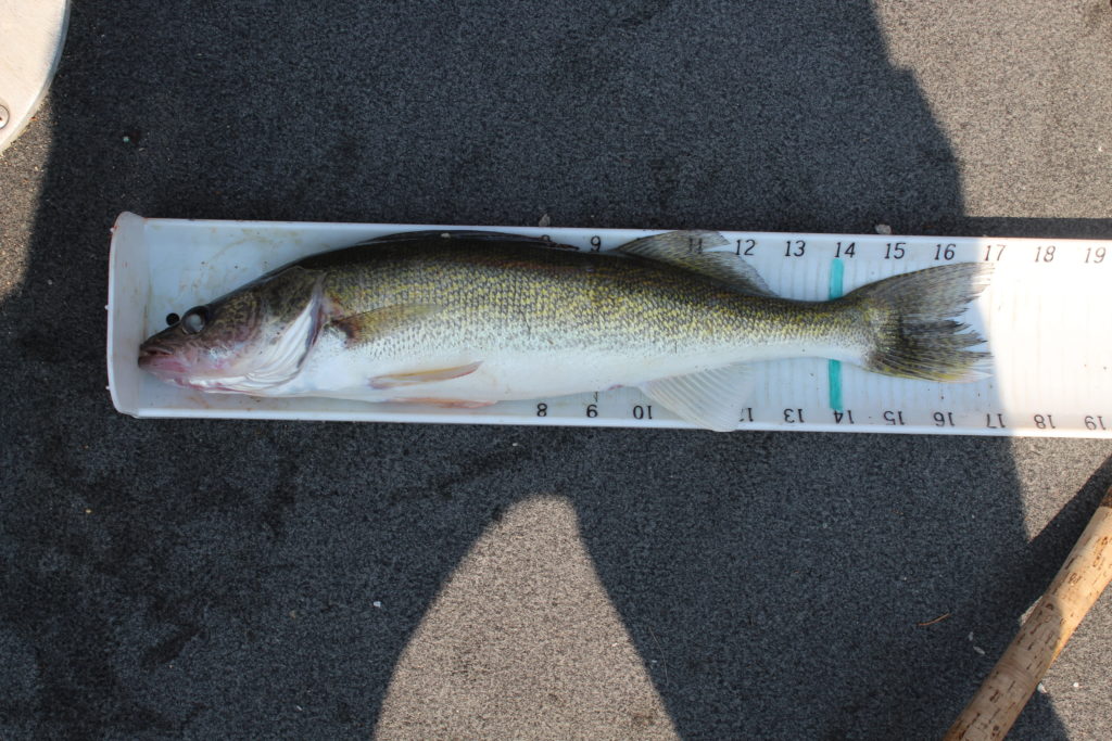
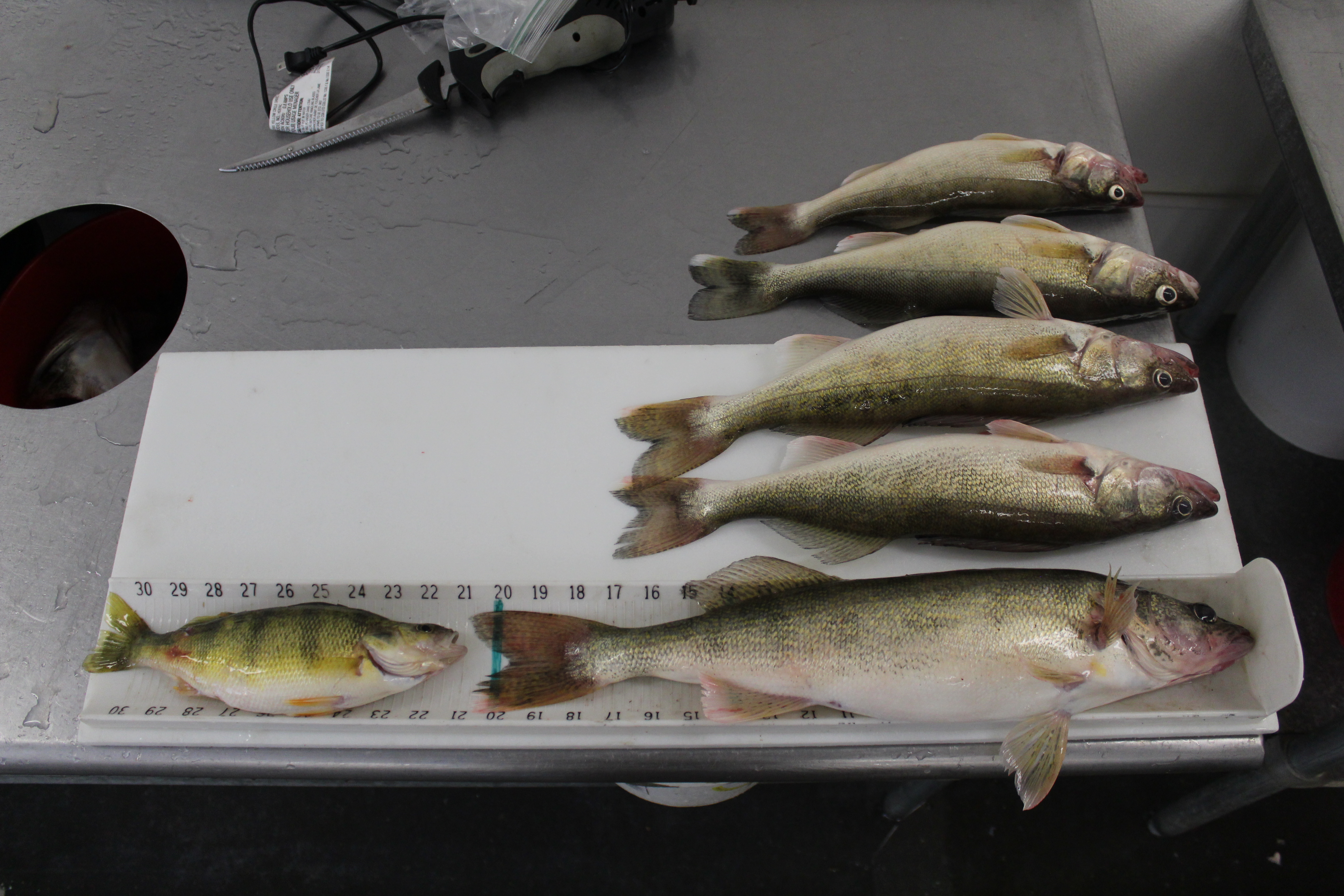
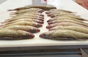
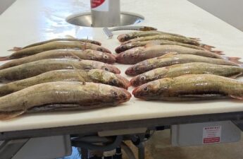
Most anglers that come to Devils Lake are looking for these. The fish you put in the box. Sure, everyone enjoys catching the occasional lunker and trophy fish, but, finding fish for the fryer is what most are after. Those 14-17/18 inch fish that make for the best eating. Although those walleyes prey on other fish species smaller than them, they are, in the grand scheme of things; prey for the super predators that swim our waters.
Case in point:
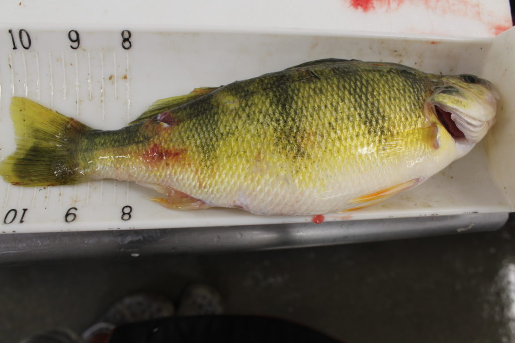
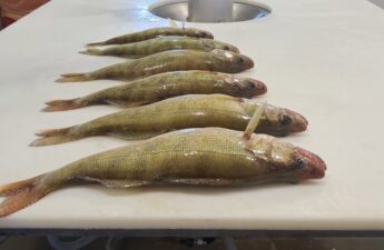
That’s a 10.5 inch Perch that almost became prey for either a big Pike or big Walleye. One hears many stories of fishermen reeling in 12-15 inch Walleyes and..
WHAM!
A big Pike locks on during the retrieve and gives everyone in the boat a little excitement. Sometimes they let go, sometimes they don’t, and you can actually get a 2 for 1.
What The Ledges Present!
We look at those old shoreline ledges in 3 parts:
- The Cut Above
- The Flat
- The Cut Below
All three areas will hold fish and all three areas will present a different reason those fish are there.
The Cut Above and Below
When I talk about The Cut, I am talking about where the contour lines on your GPS are really close together, a steep drop. There is a drastic change in water depth.
I always think of these two areas as spots where Big Fish or Super Active Fish are present. Smaller, prey fish, usually don’t hang out in this area. Doing so exposes their bellys and an exposed belly on a Perch or 12-inch Walleye is target ‘numero uno’ for Mr. Pike and Mr. Big Walleye.
We don’t spend a huge amount of time trolling the cut. A lot of times that cut is old rip rap and eroded areas that have exposed rocks and boulders. Super snaggy. Don’t get me wrong, we do test the cut every once in a while and cross is when we slip ledges, but we probably only spend 10-20% of our troll time in this area.
The Ledge: Safe Haven
Most of the time we are looking for those ‘Box Fish’, the eaters. The ledge is usually where we will find them. That ledge provides them with two things:
- Shrimp
- Protection From Below
Those ledges are also usually pretty clean and generally hold fewer snags. The old timber ledges will have some snags but pulling just above the laid down timber will both keep your lure tied up and will present your lure in the kill zone for those fish laying in ambush amongst that timber. Trial and error will usually get your line length at the right level.
How To Read What I Am Talking About!
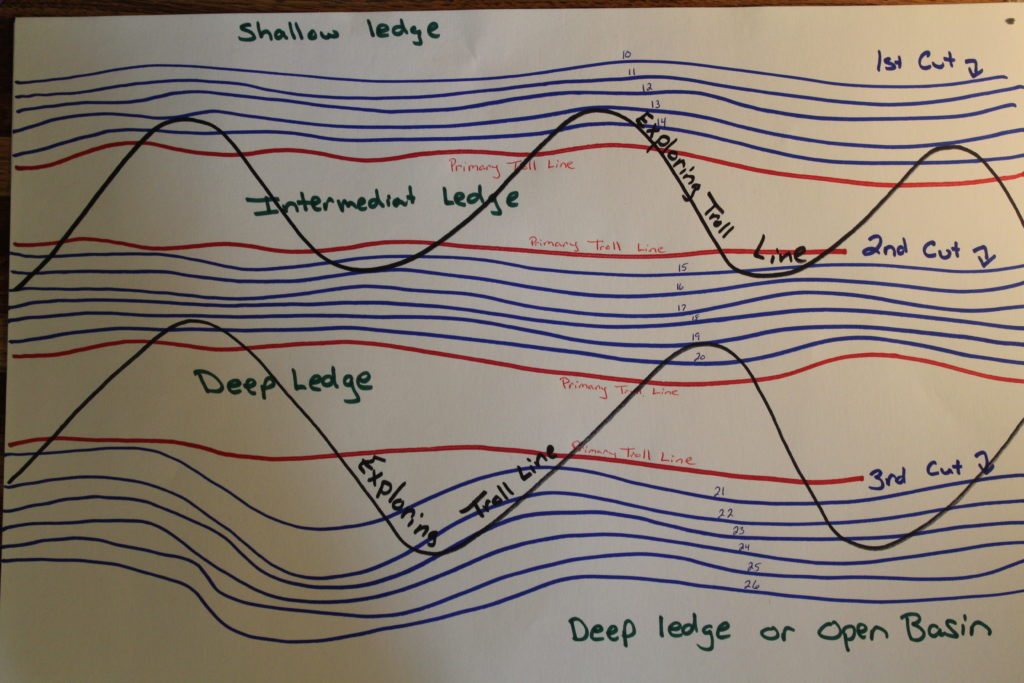
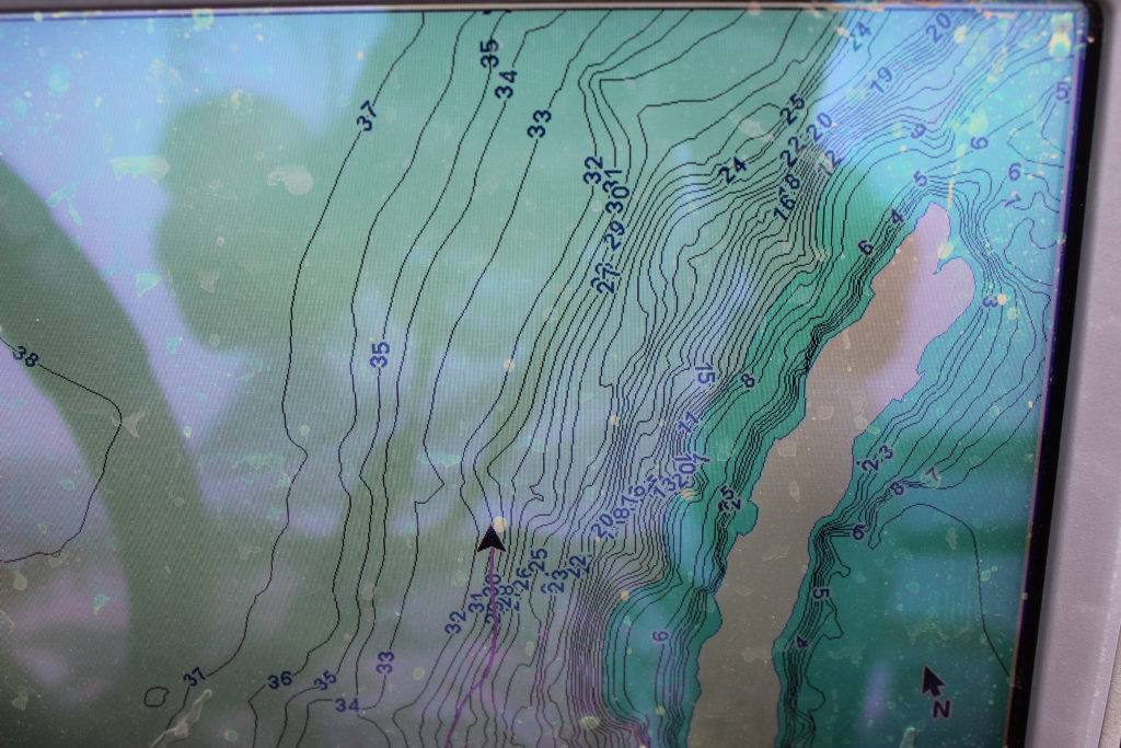
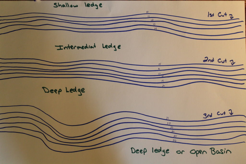 On a straight shore line your GPS is going to present to you something that looks like this. You see the 3 distinct drop offs (cuts) that fall away to an old shore line ledge. These straight shore lines can make for a nice, long troll to locate fish. Once located, the fish schools can be very easy to stay on and pick up a lot of fish in a short period of time.
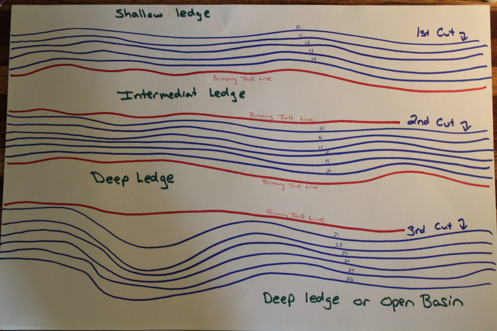 Initially, the red line represent where I would select my trolling position. Tight and up against the cuts targeting those fish that are ambushing near the cut. Those are probably going to be your more active fish.
Often times, if our primary troll lines aren’t producing fish yet we know the fish are present, we will start to do some ‘lazy ivans’, perusing the width of the ledge and segments of the cut to see of there are more active fish located outside of our primary target areas.
Ledge With Distinct Point
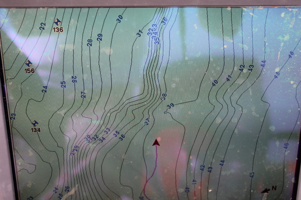
One of the structures we actively seek out, and we found a good, productive one today, is a shoreline ledge that has an abrupt point intersecting it. This is a wonderful structure to pull over the top of or even down the length of. Both produced fish for us today in 18-25 feet of water.
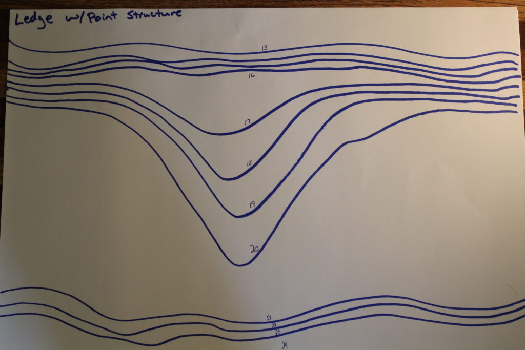
What to look for on your GPS, we spend a lot of time off the water looking for things like this on our GPS. This would be a very ideal situation. Sometimes they are a little less distinct but can still be very productive.
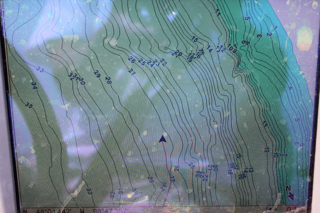
 Our initial passes today looked almost exactly like this. Our 1st two passes produced the most active fish on the point and they were the two biggest fish of the day.
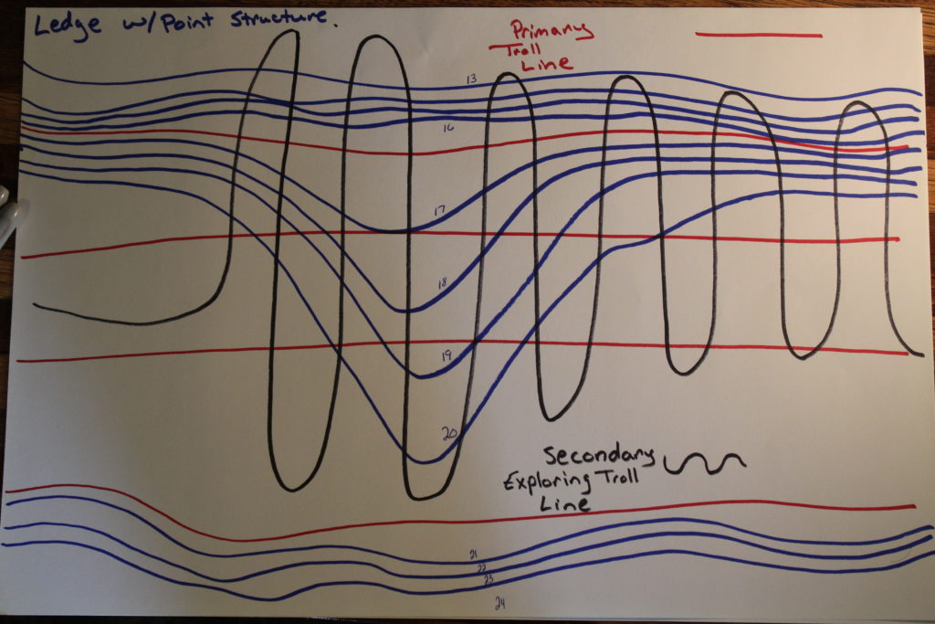
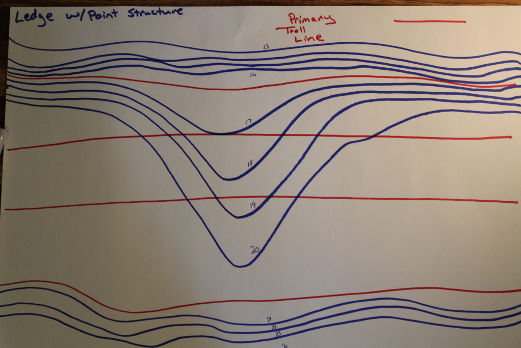
After our 3rd pass produced a goose egg, we switched strategies to explore the entire point and our GPS Trail looked almost exactly like this.
Hope This Helps!!
In a nutshell, that is how we here at DevilsLakeFishingReport attack Devils Lake’s many shoreline ledges to target Walleyes and Perch. We hope that you can apply this as well and….
Very informative…any tips on what to look for, for those with less modern mapping or no mapping???
Well, without mapping on your GPS you are going to have to explore with your depth finder a little, look for abrupt drop offs that then level out to a consistent depth. Cruising that consistent depth until you hit the next abrupt drop, that will be the width of your ledge and then just play ping pong with those two ledges.